搜索结果: 1-15 共查到“地理制图技术其他学科”相关记录178条 . 查询时间(2.265 秒)

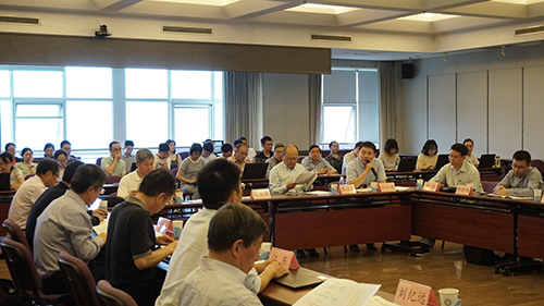
全球土壤侵蚀制图研讨会顺利召开(图)
土壤 侵蚀 制图
2024/5/28
陕西测绘地理信息局(陕西省测绘地理信息局)成立于1957年,作为自然资源部派出机构,实行由自然资源部与陕西省政府双重领导以自然资源部为主的管理体制,根据省政府的授权委托,行使陕西省测绘地理信息统一监管政府职能。陕西测绘地理信息局是全国重要的测绘地理信息生产、科研基地,承担并组织协调自然资源部部署的国家基础测绘、应急测绘以及其他全国性或重大测绘地理信息项目的实施;承担并组织协调自然资源部部署的自然资...


2019年5月12日,中国科学院A类战略性先导科技专项“美丽中国生态文明建设科技工程”(以下简称“美丽中国”专项)项目10“生态文明建设地理图景技术与应用示范”启动会在中国科学院地理科学与资源研究所召开。启动会由地理资源所所长、专项首席科学家葛全胜研究员和项目10负责人陆锋研究员主持。启动会咨询专家组由首都师范大学宫辉力教授、福建省生态环境厅信息中心柯瑞荣主任、北京大学刘瑜教授、中科院科技战略咨询...
GOPLUS GEOSPATIAL DATA SERVICE FOR INDUSTRIAL AND INFRASTRUCTURE DEVELOPMENT IN ODISHA, INDIA
GOPLUS Land Bank Ortho image Web-GIS Geospatial data Geocoded data RoR (Record of Rights)
2019/2/27
Technological advancement is the key driver for economic growth and sustainable development. Geospatial Technologies applications and tools available today are being used for improved performance of a...
山东大学科技期刊社四期刊获中国高校期刊奖励
山东大学科技期刊社 四期刊 中国高校 期刊奖励
2018/11/20
2018年11月5日,中国高校科技期刊研究会公布了2018年度全国高校“杰出·百佳·优秀科技期刊”评选结果。山东大学科技期刊社编辑出版的《山东大学学报(理学版)》被评为“中国高校百佳科技期刊”;《山东大学学报(医学版)》《山东大学学报(工学版)》《山东大学耳鼻喉眼学报》被评为“中国高校优秀科技期刊”。近年来,科技期刊社紧紧围绕学校“双一流”建设,以创建“名刊强社”为目标,认真谋划发展蓝图,实施“期...
GEOSPATIAL APPROACH FOR LANDSLIDE ACTIVITY ASSESSMENT AND MAPPING BASED ON VEGETATION ANOMALIES
Tropical rain forest Landslide activity egetation anomalies
2018/11/9
Remote sensing has been widely used for landslide inventory mapping and monitoring. Landslide activity is one of the important parameters for landslide inventory and it can be strongly related to vege...
中国石油大学(华东)2019年硕士研究生入学考试自命题数字测图原理与方法考试大纲。

中南大学地球科学与信息物理学院宋迎春教授(图)
中南大学地球科学与信息物理学院 宋迎春 教授 计算图形学
2018/8/9
GEOMATICS MAPPING OF NATURAL HAZARDS: OVERVIEW AND EXPERIENCES
Rapid Mapping Multi-temporal Geomatics Platform Sensor Landslide Mudflow Time management
2018/5/8
This paper reviews the major Geomatics solutions available on the market and explores their potentialities for rapid disaster assessment applications. The attention is primarily focused on the most re...

2017年3月21至25日, 中国科学院新疆生态与地理研究所所长雷加强研究员一行应比利时根特大学校长Anne De Paepe女士的邀请,赴比利时参加了根特大学建校200周年校庆活动。共有来自29个国家68个大学和研究机构的120多名代表出席了校长论坛和庆祝活动,现任欧洲理事会常任主席赫尔曼·范龙佩先生出席论坛开幕式并做主旨发言。
The 5th International Workshop on Web Mapping,`Geoprocessing and Services
The 5th International Workshop Web Mapping,Geoprocessing and Services
2017/3/10
WebMGS is an important event in the field of web-based GIS, which emphasizes a diverse range of topics related to new web-based developments of geospatial theories, technologies and solutions. The Web...
THE EFFECT OF UNDERWATER IMAGERY RADIOMETRY ON 3D RECONSTRUCTION AND ORTHOIMAGERY
Underwater 3D Reconstruction Underwater Image Enhancement
2017/4/5
The work presented in this paper investigates the effect of the radiometry of the underwater imagery on automating the 3D reconstruction and the produced orthoimagery. Main aim is to investigate wheth...
USING LANDSAT 8 IMAGE TIME SERIES FOR CROP MAPPING IN A REGION OF CERRADO,BRAZIL
Crop mapping Landsat Time series Random Forest algorithm
2016/12/1
The objective of this research is to classify agricultural land use in a region of the Cerrado (Brazilian Savanna) biome using a time series of Enhanced Vegetation Index (EVI) from Landsat 8 OLI. Phen...
WETLAND MAPPING WITH SAR/QUAD-POL DATA ACQUIRED DURING TANDEM-X SCIENCE PHASE
TanDEM-X wetland mapping Quad-Pol Alt-Pol
2016/11/24
The aim of this study was to exploit fully polarimetric SAR data acquired during TanDEM-X – Science Phase (2014/2015) over herbaceous wetlands of the Biebrza National Park (BbNP) in North-Eastern Pola...
ATMOSPHERIC CORRECTION,REFLECTANCE CALIBRATION AND BRDF CORRECTION FOR ADS40 IMAGE DATA
Multispectral Modelling Aerial Calibration Land Use Mapping Atmosphere Radiometry Correction
2015/12/30
A new radiometric workflow for ADS40 line scanner data has been developed and implemented. It includes now two additional atmospheric correction algorithms and an empirical BRDF correction. Both atmos...

