搜索结果: 1-15 共查到“理学 landslide”相关记录90条 . 查询时间(0.078 秒)

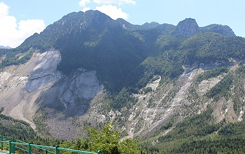
Taking a landslide's temperature to avert catastrophe(图)
Taking landslide temperature avert catastrophe
2020/7/3
Engineers at Duke University have developed a comprehensive new model of deep-seated landslides, and demonstrated that it can accurately recreate the dynamics of historic and current landsli...
LANDSLIDE HAZARD ZONATION IN AND AROUND KEDARNATH REGION AND ITS VALIDATION BASED ON REAL TIME KEDARNATH DISASTER USING GEOSPATIAL TECHNIQUES
Landslide Hazard Zonation GIS Orthorectification Drainage Density Geomorphology
2019/2/28
Landslides are one of the frequently happening disasters in this hilly state of Uttarakhand which accounts to the loss of lives and property every year especially during the rainy season which lead to...
HAZARD ASSESSMENT OF LANDSLIDE DISASTER IN FUJIAN PROVINCE BASED ON FUZZY MATHEMATICS
Landslide Hazard Assessment Fuzzy Mathematics
2018/5/15
Landslide disasters are the most frequent geological disasters in Fujian Province. They are also the type of geological disasters that cause the most serious economic and population losses each year. ...
POTENTIAL LANDSLIDE EARLY DETECTION NEAR WENCHUAN BY A QUALITATIVELY MULTI-BASELINE DINSAR METHOD
Landslide Early detection DInSAR Sentinel-1 Wenchuan
2018/5/11
Early detection of landslides is important for disaster prevention, which was still very hard work with traditional surveying methods. Interferometric Synthetic Aperture Radar (InSAR) technology provi...
RAPID EXTRACTION OF LANDSLIDE AND SPATIAL DISTRIBUTION ANALYSIS AFTER JIUZHAIGOU Ms7.0 EARTHQUAKE BASED ON UAV IMAGES
Jiuzhaigou earthquake UAV object-oriented landslide extraction spatial distribution analysis
2018/5/14
Jiuzhaigou earthquake led to the collapse of the mountains and formed lots of landslides in Jiuzhaigou scenic spot and surrounding roads which caused road blockage and serious ecological damage. Due t...
GEOSTATISTICAL ANALYSIS FOR LANDSLIDE PREDICTION IN TRANSILVANIA, ROMANIA
landslide monitoring data processing geostatistics geomatics GIS
2018/4/18
Management of spatial data by means of Geographic Information System (GIS) plays an essential role based on the latest achievements in Geomatics domain. Geomatics offers the possibility to share, comp...
LANDSLIDE IDENTIFICATION FROM IRS-P6 LISS-IV TEMPORAL DATA-A COMPARATIVE STUDY USING FUZZY BASED CLASSIFIERS
Kashmir earthquake CBSI LISS-IV Vegetation Index Temporal PCM
2018/4/18
While extracting land cover from remote sensing images, each pixel in the image is allocated to one of the possible class. In reality different land covers within a pixel can be found due to continuum...
GEOSTATISTICAL ANALYSIS FOR LANDSLIDE PREDICTION IN TRANSILVANIA, ROMANIA
landslide monitoring data processing geostatistics geomatics GIS
2018/5/8
Management of spatial data by means of Geographic Information System (GIS) plays an essential role based on the latest achievements in Geomatics domain. Geomatics offers the possibility to share, comp...
LANDSLIDE IDENTIFICATION FROM IRS-P6 LISS-IV TEMPORAL DATA-A COMPARATIVE STUDY USING FUZZY BASED CLASSIFIERS
Kashmir earthquake CBSI LISS-IV Vegetation Index Temporal PCM
2018/5/8
While extracting land cover from remote sensing images, each pixel in the image is allocated to one of the possible class. In reality different land covers within a pixel can be found due to continuum...
LANDSLIDE SUSCEPTIBILITY ASSESSMENT THROUGH FUZZY LOGIC INFERENCE SYSTEM (FLIS)
Landslide GIS Susceptibility Fuzzy logic Pakistan
2016/10/14
Landslide is among one of the most important natural hazards that lead to modification of the environment. It is a regular feature of a rapidly growing district Mansehra, Pakistan. This caused extensi...
Lichenometry dating of coseismic changes to a New Zealand landslide complex
earthquakes lichens paleoseismology
2015/9/16
Lichenometry is a surface-exposure-dating procedure that complements traditional trench-and-date stratigraphic studies of earthquakes. Lichens on the surficial blocks of a slump in the Seaward Kaikour...
Digital elevation models for landslide evolution monitoring: application on two areas located in the Reno River Valley (Italy)
Digital Elevation Model landslide GPS digital photogrammetry laser scanning
2015/9/15
GPS, digital photogrammetry and laser scanning techniques have been applied and compared in the frame of the studies of two complex landslides located in the Emilia-Romagna Region (Northern Italy). Th...
Qualitative and quantitative photogrammetric techniques for multi-temporal landslide analysis
photogrammetry DTMs generation archival photographs surface representation landslide analysis
2015/9/8
The results of two survey methods, geological photointerpretation and historical photogrammetry, are compared in order to evaluate the temporal evolution of a unstable slope located in the Tuscan-Emil...
Cavola experiment site: geophysical investigations and deployment of a dense seismic array on a landslide
landslide seismic array borehole measurements seismic refraction H/V noise spectral ratios
2015/9/2
Geophysical site investigations have been performed in association with deployment of a dense array of 95 3-component
seismometers on the Cavola landslide in the Northern Apennines. The aim of the ar...
The contribution of EMCA to landslide susceptibility mapping in Central Asia
Earthquake-triggered landslides Landslide susceptibility Central Asia
2015/8/17
Central Asia is one of the most exposed regions in the world to landslide hazard. The large variability of local geological materials, together with the difficulties in forecasting heavy precipitation...

